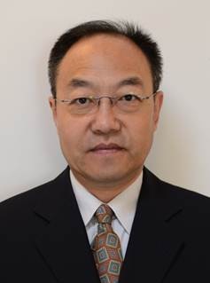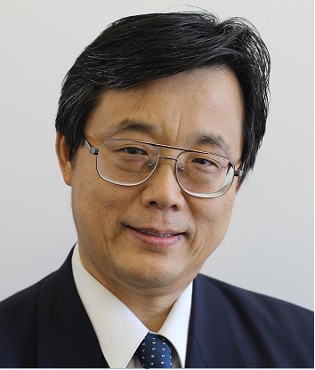
Prof. Michael F. Goodchild
Academician
American Academy of Sciences
Chair, Executive Committee,
National Center for Geographic Information & Analysis at the
University of California, Santa Barbara
Director
Center for Spatial Studies
University of California, Santa Barbara
Keynote Speech Title: Planning in a Geospatially Enabled Society
Michael F. Goodchild is Professor of Geography at the University of California, Santa Barbara, and Director of UCSB’s Center for Spatial Studies. He received his B.A. degree from Cambridge University in Physics in 1965 and his Ph.D. in geography from McMaster University in 1969, and has received four honorary doctorates.
He was elected member of the National Academy of Sciences and Foreign Member of the Royal Society of Canada (2002), member of the American Academy of Arts and Sciences (2006), and Foreign Member of the Royal Society and Corresponding Fellow of the British Academy (2010); and in 2007 he received the Prix Vautrin Lud. He was editor of Geographical Analysis between 1987 and 1990 and editor of the Methods, Models, and Geographic Information Sciences section of the Annals of the Association of American Geographers from 2000 to 2006. He serves on the editorial boards of ten other journals and book series, and has published more than 15 books and 400 articles.
He was Chair of the National Research Council’s Mapping Science Committee from 1997 to 1999, and currently chairs the Advisory Committee on Social, Behavioral, and Economic Sciences of the National Science Foundation. His current research interests center on geographic information science, spatial analysis, and uncertainty in geographic data.

Prof. Li Deren
Academician
Chinese Academy of Sciences (CAS)
Chairman
Academic Commission of Wuhan University
Chairman
National Laboratory for Information Engineering in Surveying, Mapping and Remote Sensing (LIESMARS)
Keynote Speech Title: Smart City:Concept, Supporting Techniques and Applications
Prof. Dr. Ing Li Deren is a scientist in photogrammetry and remote sensing; has dual membership of both the Chinese Academy of Sciences and the Chinese Academy of Engineering; is a member of the Euro-Asia International Academy of Science; Professor and PhD supervisor of Wuhan University; Vice-President of the Chinese Society of Geodesy, Photogrammetry and Cartography; and is Chairman of both the Academic Commission of Wuhan University and the National Laboratory for Information Engineering in Surveying, Mapping and Remote Sensing (LIESMARS).
He has concentrated on the research and education in spatial information science and technology represented by remote sensing (RS), global positioning system (GPS) and geographic information system (GIS). His majors are the analytic and digital photogrammetry, remote sensing, mathematical morphology and its application in spatial databases, theories of object-oriented GIS and grid GIS as well as mobile mapping systems, etc.
Prof. Li Deren served as Comm. III and Comm. VI president of ISPRS in 1988-1992 and 1992-1996, worked for CEOS in 2002-2004 and president of Asia GIS Association in 2003-2006. He got Dr.h.c. from ETH in 2008.

Prof. Milan Konecny
Academician, President of European Research Center, International Eurasian Academy
President (Former), International Cartographic Association (ICA)
Vice-President, International Society for Digital Earth (ISDE)
Chairman of ICA Commission Cartography on Early Warning and Crises Management
Director ; Laboratory on Geoinformatics and Cartography, Masaryk University, Brno , Czech Republic
Knight of Brasilian Cartography
Dr.h.c., University of Architecture, Civil Engineering and Geodesy (UACEG), Sofia, Bulgaria
Honorary Professor, Siberian State Academy of Geodesy (SSGA), Novosibirk, Russia
Honorary Member of Spanish Society for Cartography, Photogrammetry and Remote Sensing
Keynote Speech Title: Early Warning and Disaster Management Challenges for Europe and China: from GIS to VGE
Prof. Konecny was awarded Doctor of Geographical Sciences from Masaryk University in 1982. He served as Lecture, Associate Professor and Professor of Masaryk University, Czech Republic during 1982 - onwards. He is currently the Professor of Geodesy and Cartography of the same university, Professor of Geoinformatics and Regional Geography at University of Konstantina Filozofa, Nitra, Slovakia, Guest Profesor of Vienna University, Austria, the Honorary Professor of the Siberian State Academy of Geodesy Novosibirsk and Doctor Honoris Causa of University of Architecture, Engineering and Geodesy in Sofia, Bulgaria. Prof. Konecny takes the leadership in many international professional bodies, during 2003-7 was President of International Cartographic Association (ICA (contemporary past president), now serves as chairman of ICA Working Group “Cartography on Early Warning and Crises Management”, the Vice-President of International Society for Digital Earth (ISDE) and Academician and President of European Joint Research Center of International Eurasian Academy. He is also Director of Czech Focal Point for Geographical Information Group (GISIG). He is the member of editorial board for top journals including the International Journal on Digital Earth (IJDE), Geoinformatica and International Journal of Geoinformatics. Prof. Konecny is the council member of Czech Cartographic Association and member of International Advisory Board of Center of Earth Observations and Digital Earth (CEODE), CHAS, Beijing. He organized many high level international conferences at his country and abroad (incl. China -EU high level seminar of EW and CM in Beijing in 2009). His research interests include the role of geoinformatics and cartography in Early Warning and Crises Management, dynamic geovisualization, creation of SDI in Europe (he is expert of INSPIRE and GMES), design of Information and Knowledge-based Society. He is a co-author of first GIS book in Europe in 1985 and editor of EW and CM book in Springer Verlag (.in 2010).

Prof. Daniel Sui
Distinguished Professor of Social & Behavioral Sciences
Chair, Department of Geography
The Ohio State University
Columbus, Ohio, U.S.A.
Director, Geographic Analysis Core
Institute for Population Research (IPR)
The Ohio State University
Columbus, Ohio, U.S.A
Keynote Speech Title: Crowdsourcing Geographic Knowledge through Open GIS
Daniel Sui is currently a Professor of Geography and Distinguished Professor of Social & Behavioral Sciences at the Ohio State University. He also serves as Chair of Geography (since July 2011) and Director of the Geographical Analysis Core, Institute of Population Research (IPR) (since September 2012). He served as Director of the Center for Urban & Regional Analysis (CURA) (2009-2012). Sui holds adjunct professorship at the John Glenn School of Public Affairs, Knowlton School of Architecture (City & Regional Planning Program), and College of Public Health at OSU. Prior assuming his current position at OSU in July 2009, Daniel Sui was a professor of geography (1993-2009) and holder of the Reta A. Haynes endowed chair (2001-2009) at Texas A&M University. He holds a B.S. (1986) and M.S. (1989) from Peking University and Ph.D. from University of Georgia (1993). His research current interests include theoretical issues of GIScience, spatial-temporal synergetics, volunteered geographic information, crowdsourcing geographic knowledge production, and open GIS as a new paradigm for GIS research and education. Sui was a 2009 Guggenheim Fellow. He is also a current member of the U.S. National Mapping Science Committee and serves as editor-in-chief for GeoJournal. More information about Sui’s current research can be found at: http://www.geography.ohio-state.edu/our-department/faculty-more/sui

Prof. Yunfeng Kong
Professor in Geographic information science,
College of Environment and Planning, Henan University
Associate Director, Key Lab. of Geospatial Technology for the Middle & Lower Yellow River Regions
Ministry of Education of China (Henan University)
Keynote Speech Title: Spatial Optimization for Compulsory School Location-Allocation and School Bus Routing
Yunfeng Kong is currently a professor in geographic information science at Henan University. He also serves as associate director of Key Lab. of Geospatial Technology for the Middle & Lower Yellow River Regions, Ministry of Education of China (Henan University). He holds degrees of B.Eng. (1989) in surveying engineering from Guilin College of Geology, M.Eng. (1992) in surveying engineering from Tongji University and Ph.D.(2001) in geography from Chinese University of Hong Kong. His research interests include GIS analysis and design, GIS project management, geographic hypermedia systems, spatial analysis and optimization, and GIS applications in social science. Before joining Henan University in 2004, he served as chief engineer for several software companies.

Prof. Yeqiao Wang
Professor in Terrestrial Remote Sensing
University of Rhode Island
Director, Key Laboratory of Poyang Lake Wetland and Watershed Research
Ministry of Education
Keynote Speech Title: Geospatial Information for Monitoring, Reporting and Forecasting of the Changing Environments
Yeqiao Wang received his M.S. and Ph.D. degrees in natural resources management & engineering from the University of Connecticut in 1992 and 1995, respectively. He is currently a professor in terrestrial remote sensing at the Department of Natural Resources Science, University of Rhode Island. He is a scholar of the Recruitment Program of Global Experts and a Yangtze River Scholar Lecturing Professor in China. He held a position of Assistant Professor in GIS and remote sensing in the Department of Geography/Department of Anthropology, University of Illinois at Chicago between 1995 and 1999 prior to his current employment.
Among his awards and recognitions Dr. Wang was a recipient of the Presidential Early Career Award for Scientists and Engineers (PECASE) by President William J. Clinton in 2000. His specialties are in terrestrial remote sensing and modeling in natural resources analysis and mapping. He is the Editor-in-Chief of Taylor and Francis Group’s Encyclopedia of Natural Resources and serves on editorial boards of other journals and book series. His study areas include various regions of the United States and China, and East and West Africa.

Dr Gang-Jun Liu
Senior Lecturer in Geospatial Sciences
School of Mathematical and Geospatial Sciences
College of Science, Engineering and Health
RMIT University
Keynote Speech Title: Location-Enabled Approaches to Australia's Ageing in Place Strategy
Gang-Jun Liu received his BSc degree in Geography from Henan University, pursued postgraduate studies in Spatial Analysis at Peking University, and received his PhD degree in Geographical Analysis from Monash University. He held the position of Senior GIS and Remote Sensing Specialist in the Department of Sustainability and Environment, Victoria, Australia, between 1996 and 2002 before joining RMIT University. He is an active member of the Geospatial Research Group and the SPACE Research Program at RMIT University, an Adjunct Professor of Henan University, and an Adjunct Research Professor of Henan Institute of Geographical Research. He has served as the President of Chinese Students and Scholars at Monash University, the President of Chinese Professionals Club of Australia, and is currently the President of Henan University Alumni Association in Australia.
His researches have been in the development and application of digital geospatial information techniques and products to support sustainable development at both local and regional levels. He has developed the first state-wide 20m resolution digital elevation model for Victoria; GIS-based approaches to the extraction of fine resolution hydrographical features / breaklines from located air-borne LIDAR point clouds; a discrete wavelet based image fusion algorithm; state-wide climate surfaces for Tasmania; DEM-based methods for mapping riparian zones, variable width stream buffers, floodplains, potential breeding habitats of endangered species, and potential breeding habitats of malaria transmitting mosquitoes; 3D network models and 3D GIS applications; and indicators of location disadvantage for non-driving seniors in urban space. His current research is on GIS-based approaches to the mapping and understanding of spatial variation in spatial accessibility to essential community services / facilities / resources, and identifying areas of location disadvantage for different population groups at fine spatial resolution in both urban and rural contexts.

